Storms Cause Damage, Power Outages In Northeast Iowa [PHOTOS]

Strong thunderstorms that moved across northeast Iowa caused damage and knocked down power lines and trees Tuesday afternoon.
Multiple severe thunderstorm warnings were issued for the region during the afternoon hours. A 61 MPH wind gust was reported at the Waterloo Regional Airport at 2:19 PM, a 60 MPH gust was clocked at Fairbank at 2:30 PM and golf ball-size hail fell at Manchester just before 3:30 PM.
Portions of Bremer and Fayette counties were among the areas hardest hit.
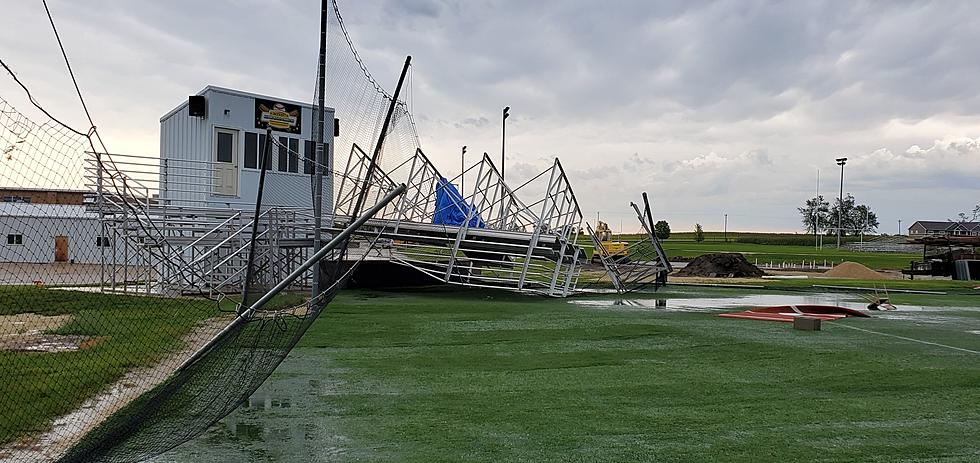
Straight-line winds appear to have caused plenty of damage at Wapsie Valley High School, where bleachers behind home plate at the Warriors' baseball field were left mangled and bent. Other bleachers along the third base line were blown nearly 200 feet over the fence in center field.
North of the school's rural campus, Iowa Highway 3 was closed for a time after high winds overturned a semi.
In Fairbank, the storm knocked down multiple trees and power lines throughout the city and at Island Park. Fayette County sheriff's officials reported that multiple trees were also knocked down in and around the city of Oran.
In Waterloo, high winds snapped a large tree branch near the intersection of W. 9th Street and Ridgeway Ave. Authorities said the tree pulled down a power line, which fell on top of an occupied vehicle.
The storms knocked out power to nearly 3,000 customers of Mid-American Energy in Northeast Iowa. Company officials said there were more than 750 outages in Waterloo.
The weather system dropped some much-need precipitation on parched areas of the state. Waterloo reported 1.79 inches of rain in a short amount of time. Independence received .94 inches.
Northeast Iowa Storm Damage - Tuesday, Aug. 24, 2021
Gallery Credit: Elwin Huffman - Townsquare Media
KEEP READING: Get answers to 51 of the most frequently asked weather questions...
More From K92.3