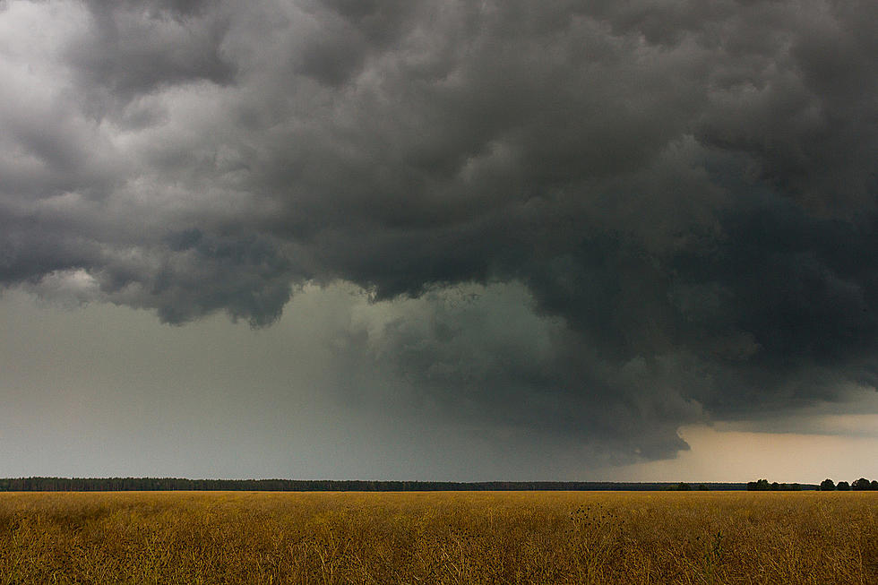
Well, it turns out that it's actually Severe Weather Awareness Week and if you're looking to chase some awesome storms, do I have an idea for you. While this is not an official "storm chasing" certification this could be the next best thing, especially in Northeastern Iowa. It's pretty simple to be a storm spotter in Iowa.
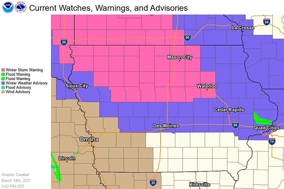
The Winter Storm Warning has expanded east and now includes Black Hawk, Bremer, and Grundy Counties. The warning begins at 1 AM Monday and continues until 4 PM Monday. (see warning map below)
From the National Weather Service in Des Moines:
Northern Iowa will see snow accumulations top 6 inches with areas along portions of the Iowa/Minnesota border around 8 to 9 inches...
**Updated Friday 3/12 at 5 AM**
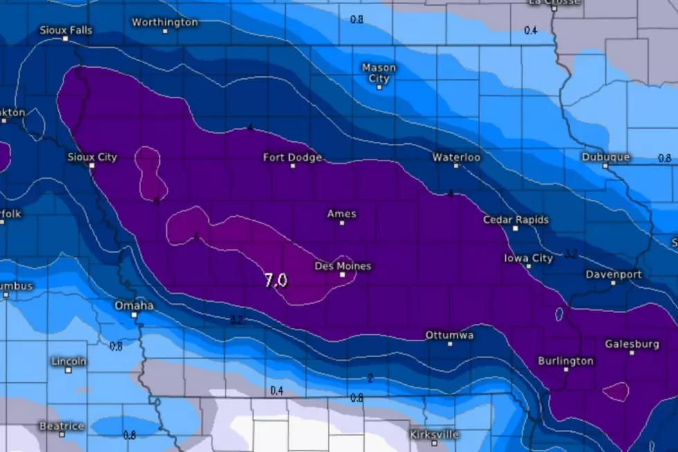
Mother Nature can be cruel.
After setting record high temperatures in parts of Iowa on both Tuesday and Wednesday, there’s a chance that the state could get drilled by Winter Weather early next week…seriously...
Sick of snow? Spring begins on March 20th!
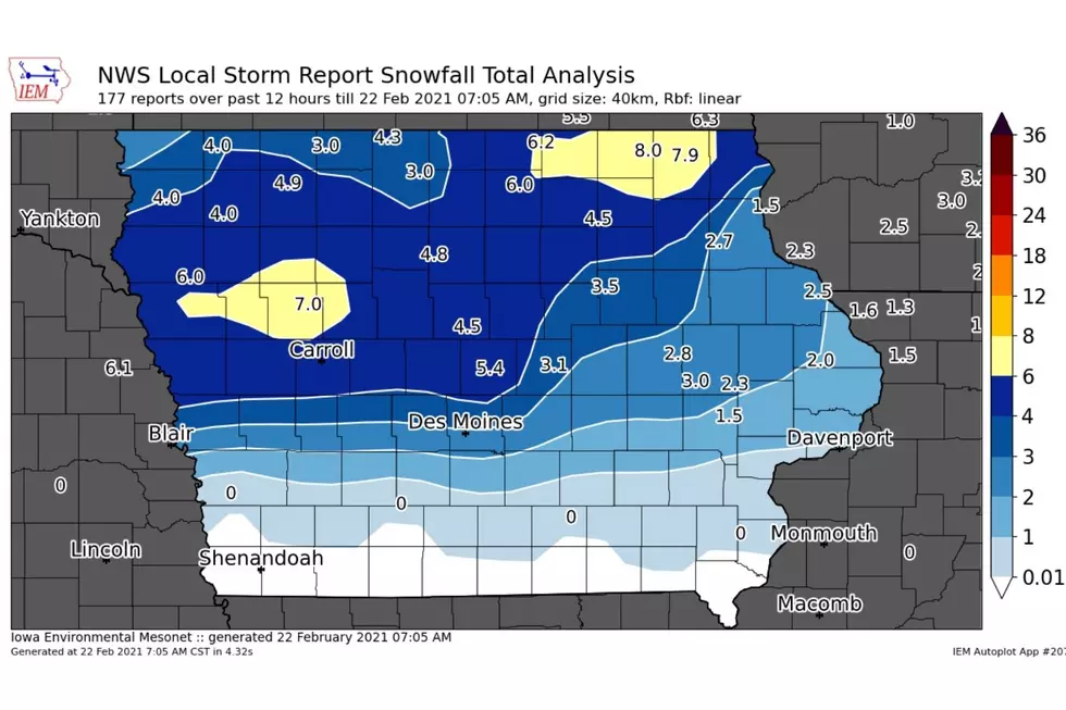
SNOW TOTALS from 2/21:
Onawa: 9.5"
Woodbine: 9"
Riceville: 8.3"
Cresco: 8"
Mason City: 6"
Charles City: 5.2"
Ames: 4.5"
Waterloo: 3.5"
Tripoli: 2.4"
Fayette: 2"
So far this month, Waterloo has accumulated 14...
Video shot by Chris Fitzmorris in Kenner, Louisiana, shows electrical power surging through the lines at the same time a transformer went down as a winter storm ripped through the state.
Thousands of people were without power across Louisiana as icy winter storms move across the state on Monday morning...
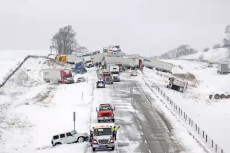
The Iowa DOT Tweeted at 1:50 PM that a multi-vehicle crash involving numerous semi-trucks occurred on I-80 west of Newton. About 40 vehicles were involved in the crash.
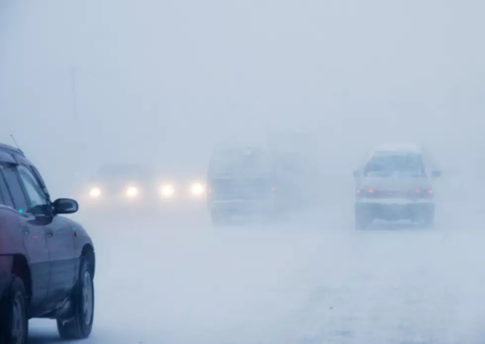
A major winter storm is set to hit Iowa Monday into Monday night. This storm will feature the potential for a lot of snow, and combined with gusty winds and blowing this, the storm will make travel very difficult at times.
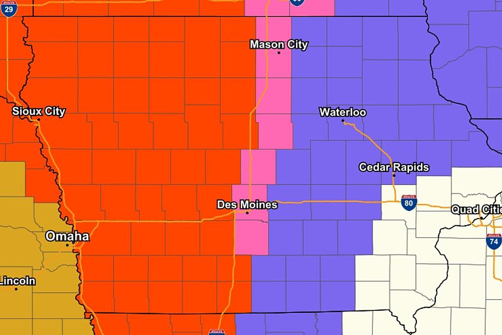
AS OF 6 AM 1/24: The National Weather Service in Des Moines forecasts that southern Iowa can expect 8-12" of snow, while areas North of I-80 are less certain at this point.
The western half of the state is in a BLIZZARD WARNING.
The areas included in the Blizzard Warning can expect a total of 4-10" of snow and winds gusting as high as 50 MPH.
The Blizzard Warning will go into effect at 6 PM Thursday through 6 PM Friday...